The collaboration between IGOT and IGME provided essential information for the Mallorca simulation and for the assessment of unstable terrain in Lisboa.
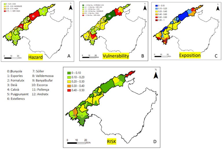
During this stay, they worked on vulnerability, susceptibility, exposure and risk due to rock falls in the Serra de Tramuntana (Mallorca). The results generated form part of the deliverable of project E.4.3.2 "Technical report on the cartographic products generated in Mallorca" and were used as support material in the emergency drill carried out at the end of April in Mallorca. Also during this stay, other tasks and field campaigns were carried out to evaluate unstable terrain detected by InSAR in the surroundings of Lisboa.

Maps produced by the IGOT and IGME teams of the hazard, vulnerability, exposure and risk of landslides in the municipalities of the Tramuntana mountain range in Mallorca. A. Landslide hazard map. B. Map of the vulnerability of society to landslides. C. Map of elements exposed to landslides. D. Map of landslide risk. These and other maps were used by the emergency teams in the emergency drill carried out in Mallorca.

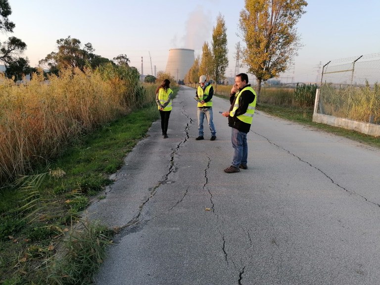
Photograph showing Cristina Reyes (IGME), José Cuervas (University of Oviedo) and Sergio Oliveira (IGOT) in a field campaign, where they identified damage linked to land subsidence near the Ribatejo thermoelectric power plant (Lisboa).


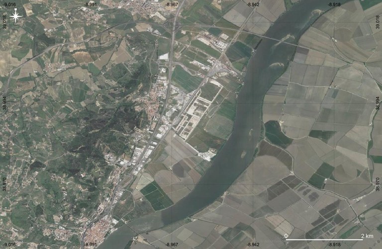
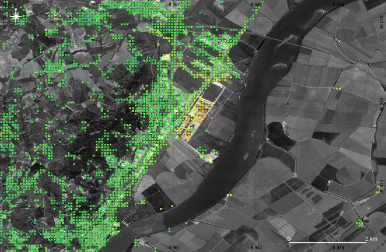
Satellite image (top) and InSAR displacement map (bottom) of the Castanheira do Ribarejo area (Lisboa) where the thermoelectric power plant mentioned in the previous image is located. A clear subsident zone of unknown origin is observed, coinciding with an urbanised area. The observed velocities are in the range between 1 and 3 cm/year.
